usmbguest5318
Gold Member
Why were so many people in Houston and other areas that were predicted to get "slammed"/flooded by Harvey?
Would not "roughing it" on a dry or at least not flooded area by sleeping in the woods (in a tent or not), inside or atop a vehicle, in a barn, in an abandoned building, on a town sidewalk, a youth hostel, a shelter in another town/city, etc. be a better situation in which to await the hurricane and its effects' passage? I would think so because...
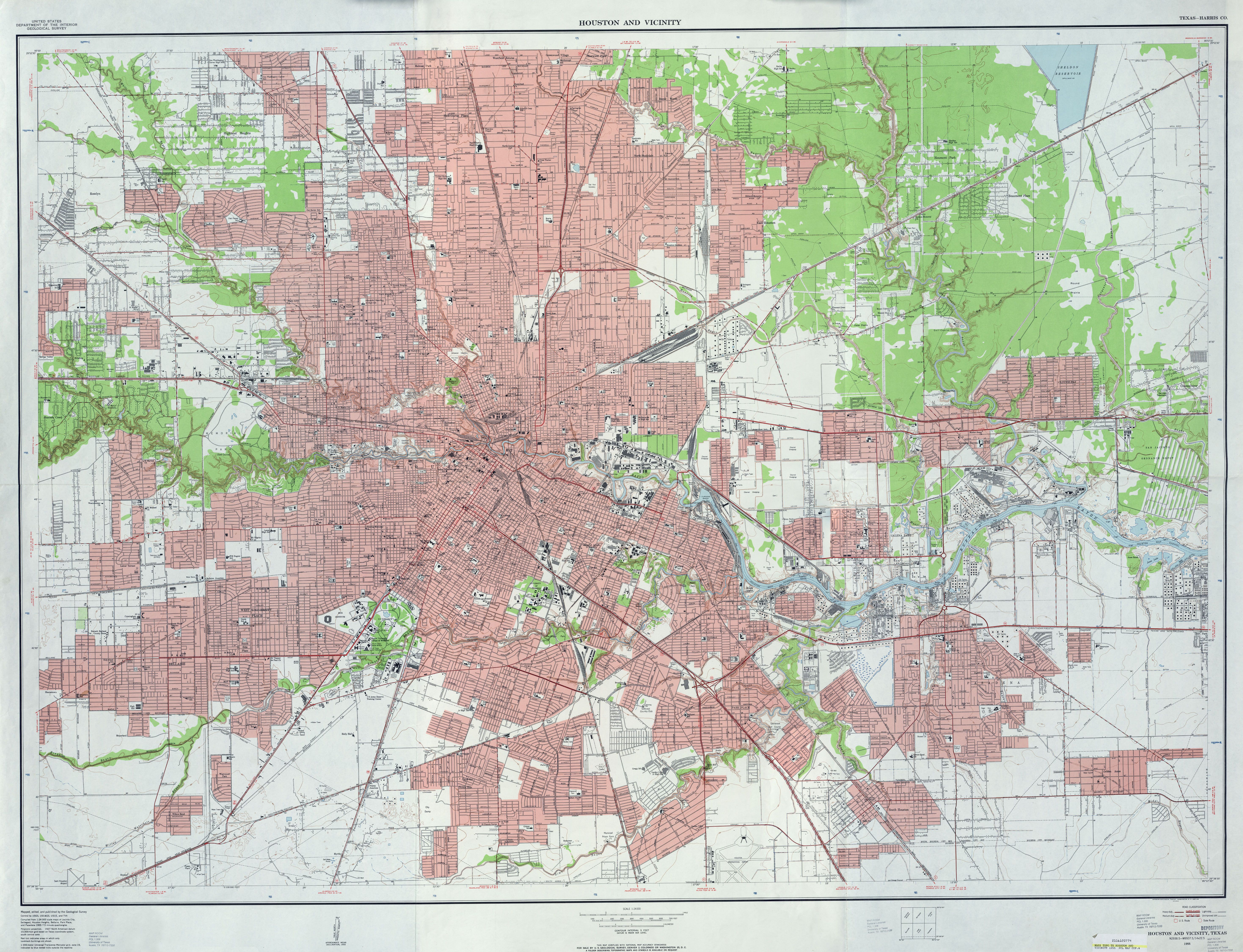
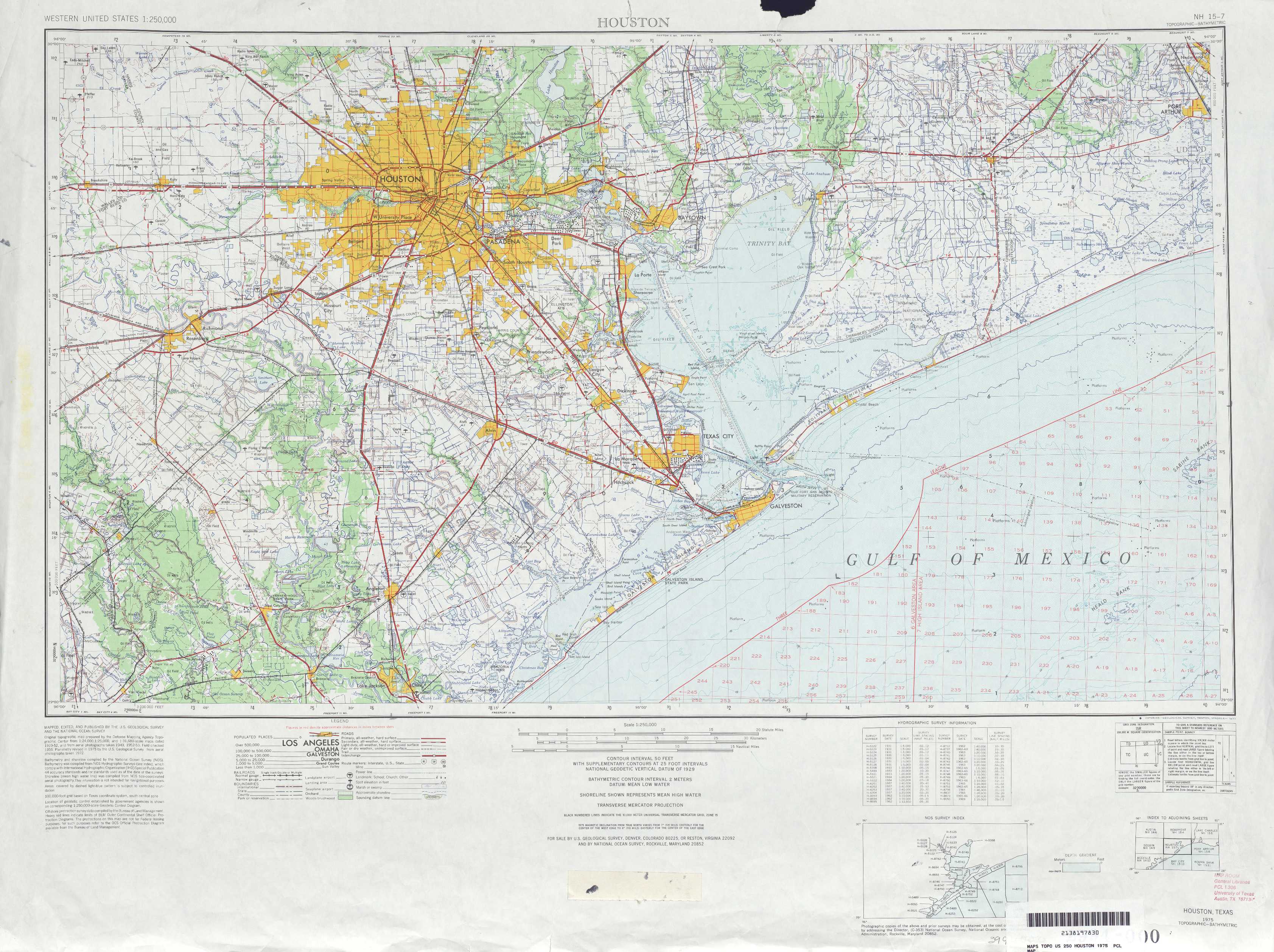
What motivated my creating this thread? Well, the fact that so many people who live in Houston and the surrounding area simply ignored the reality that is the lay of the land in Houston. (click the maps to see them enlarged enough to see the topo lines.)


That big bodies of water abutting Houston sits are called "bays," not "bathtubs." When is coming one's way -- and one is in Houston, New Orleans, Miami, and other low lying cities at the water's edge -- a hurricane that's predicted to drop some 26" to 40" of water, the smart thing to do is not be there when the hurricane arrives. Just as I can look at the topography and tell "oh, sh*t, there'a lot of water coming in from the sea and down from the sky," you know damn well the people who actually live there can do the same, and have more reason than the mere curiosity motivating me to look at a topo map of Houston.
There's also this...there is no city in the U.S. that won't have extensive flooding if 20+ inches of rain falls on it in a storm. (IIRC, the minimum amount of "single event" rain needed to guarantee flooding in any U.S. city is something like eight or ten inches.) The high ground -- ridges and hilltops -- won't get flooded in many instances, but the valleys between the ridges and hills can and will and flood. That they do is why farms thrive in valleys....all the nutrients run off the hill and mountain sides and settle in valleys and on plains.
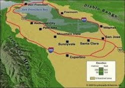
The size of valleys varies. The one above is somewhat large. The one below is rather small.

Here's a depiction of a really, really big valley. It's so big that under it is part of an aquifer system.

The thing is that one doesn't need to live in a valley as big as the ones depicted above for the valley to flood. Accordingly, people in Houston had to know they lived either in what is topographically a swamp, valley or a plain. How do they know? Well, the fact that there're no mountains right is big clue. The relative flatness of the land is another.
Just now I heard that a levy is at its limit and people who live/work around and in the direction the levy's water will flow are being advised to leave. Lord only knows if they will.
Would not "roughing it" on a dry or at least not flooded area by sleeping in the woods (in a tent or not), inside or atop a vehicle, in a barn, in an abandoned building, on a town sidewalk, a youth hostel, a shelter in another town/city, etc. be a better situation in which to await the hurricane and its effects' passage? I would think so because...
- sitting in a flooded home with no electricity or having it and risking being electrocuted,
- having no running potable water,
- very plausibly having no hygienic restroom facilities (which means one will be in the water with one's and others' bodily waste),
- possibly commingling unavoidably with garbage and any manner of other (bio) hazardous materials and "creatures" floating around in the water,
- competing with animals like gators and moccasins that are (1) better adapted to flooded environs and (2) looking for dry ground just as I would be,
- etc....
What motivated my creating this thread? Well, the fact that so many people who live in Houston and the surrounding area simply ignored the reality that is the lay of the land in Houston. (click the maps to see them enlarged enough to see the topo lines.)
That big bodies of water abutting Houston sits are called "bays," not "bathtubs." When is coming one's way -- and one is in Houston, New Orleans, Miami, and other low lying cities at the water's edge -- a hurricane that's predicted to drop some 26" to 40" of water, the smart thing to do is not be there when the hurricane arrives. Just as I can look at the topography and tell "oh, sh*t, there'a lot of water coming in from the sea and down from the sky," you know damn well the people who actually live there can do the same, and have more reason than the mere curiosity motivating me to look at a topo map of Houston.
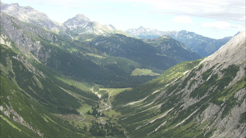
There's also this...there is no city in the U.S. that won't have extensive flooding if 20+ inches of rain falls on it in a storm. (IIRC, the minimum amount of "single event" rain needed to guarantee flooding in any U.S. city is something like eight or ten inches.) The high ground -- ridges and hilltops -- won't get flooded in many instances, but the valleys between the ridges and hills can and will and flood. That they do is why farms thrive in valleys....all the nutrients run off the hill and mountain sides and settle in valleys and on plains.
The size of valleys varies. The one above is somewhat large. The one below is rather small.
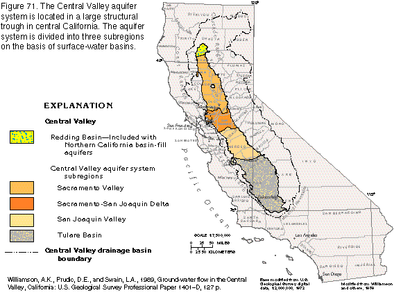
Here's a depiction of a really, really big valley. It's so big that under it is part of an aquifer system.
The thing is that one doesn't need to live in a valley as big as the ones depicted above for the valley to flood. Accordingly, people in Houston had to know they lived either in what is topographically a swamp, valley or a plain. How do they know? Well, the fact that there're no mountains right is big clue. The relative flatness of the land is another.
Just now I heard that a levy is at its limit and people who live/work around and in the direction the levy's water will flow are being advised to leave. Lord only knows if they will.
")