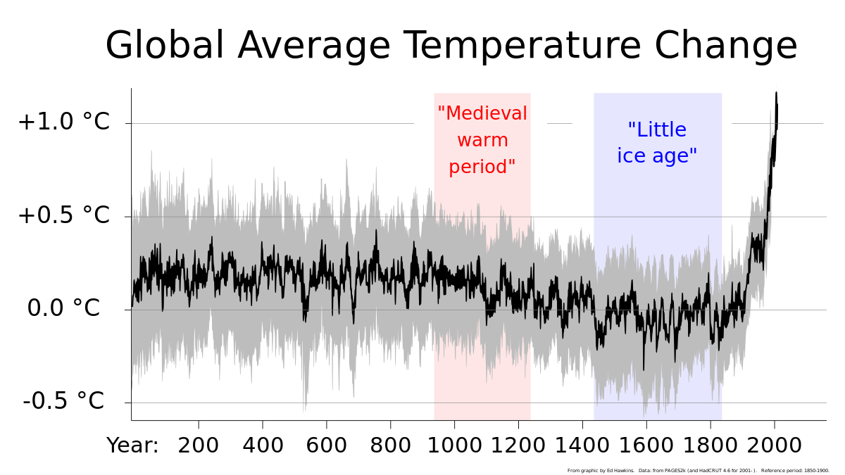
DukeU
Diamond Member
Here are two side by side weather map from the same date
They are over 3 decades apart
Notice anything about them?
View attachment 966273
View attachment 966274
"The PRISM Climate Group gathers climate observations from a wide range of monitoring networks, applies sophisticated quality control measures, and develops spatial climate datasets to reveal short- and long-term climate patterns. The resulting datasets incorporate a variety of modeling techniques and are available at multiple spatial/temporal resolutions, covering the period from 1895 to the present. Whenever possible, we offer these datasets to the public, either free of charge or for a fee (depending on dataset size/complexity and funding available for the activity)."
PRISM Climate Group at Oregon State University
"The Real-Time Mesoscale Analysis (RTMA) is a NOAA National Centers For Environmental Prediction (NCEP) high-spatial and temporal resolution analysis/assimilation system for near-surf ace weather conditions. Its main component is the NCEP/EMC Gridpoint Statistical Interpolation (GSI) system applied in two-dimensional variational mode to assimilate conventional and satellite-derived observations."
NOAA Real-Time Mesoscale Analysis (RTMA) / Unrestricted Mesoscale Analysis (URMA) - Registry of Open Data on AWS
It was hotter in the Dakotas, mid-west and south in 1988 than 2024, look at the numbers.