Oh wow!

Old Rocks

Diamond Member
Oct 31, 2008
63,085
9,752
Here is the last 24 hours of total precipitable water (link in previous TPW post), yet another arm has been ejected. The global view, embedded in the lower right corner, shows the origin and causation story goes far beyond the Caribbean and involves the overall equatorial circulation.
index.php

24 hrs of warm humid air import to Arctic Ocean.gif (4260.39 kB, 700x580 - viewed 937 times.)

Looks like Santa is going to need pontoons on his sleigh.
 
That's from day 320 though. The previous "spike".

index.php


ip.gif
Logged
Reality is merely an illusion, albeit a very persistent one - Albert Einstein

Nothing to see here, folks. Just keep moving along and close your eyes.
 
2015 and 2016 average DMI temperatures north of 80' latitude shown
index.php

dec2015.jpg (36.96 kB, 575x392 - viewed 2111 times.)
index.php

Dec2016.jpg (37.03 kB, 574x394 - viewed 2129 times.)

Comparing 2015 to 2016, if we don't get a strong freeze in the next two months, we may see the Arctic Ocean ice free for the first time this coming summer.
 
index.php


Looks like they are going to have warm temps for a while.


Oh? Let's take a look shall we? So, the maps are generated from forecasts, and models. Soooooooooo in oooother wooooords....they'rrrrrrrrre not reeeeeeaaallll.....

"These weather maps are generated from the NCEP Climate Forecast System version 2 (CFSV2) and CFS Reanalysis (CFSR) model frameworks. CFSV2 is the core of NCEP's operational Global Forecast System (GFS) model, available for April 2011 onward. CFSR is based on version 1 of CFS, and constitutes a state-of-the-art 3rd generation reanalysis. CFSR is available for January 1st, 1979 to 31 March, 2011 on a T382 gaussian grid (~38 km) with 64 vertical levels. CFSR/CFSV2 output fields shown here are from 0.5°x0.5° rectilinear grids downloaded from NCAR CISL Research Data Archive. Daily averages are computed from 3-hourly forecast fields beginning at 0000 UTC. The graphics here are generally updated at the end of each month (e.g., January output images are made at the beginning of February, and so on)."


They have a high probability of turning out true...Well, of course, you crap on everything that is science. Models are a important part of weather forecasting...Oh'nooo's we can't have models.
 
Cool stuff!!

See a lot of deep blue in there too!!!:2up:

As I posted up a couple of days ago, this is an event that happens about twice every decade at least since 1950. The cold air doesn't just disappear.........it just moves south.

"It was also shown that these warming events at the pole occur once or twice each decade with an event in 2014 and the earliest event that has been so far identified taking place in 1959. The 1959, 2014 and 2015 events share a number of common characteristics including the presence of a deep extra-tropical cyclone in the vicinity of the pole that transported warm and moist air towards the pole. All events also were associated with a highly perturbed polar vortex that brought the jet stream close to the pole."

The December 2015 North Pole Warming Event and the Increasing Occurrence of Such Events : Scientific Reports

Common characteristics? Cyclones in the vicinity of the pole:bye1::bye1:

Only a little bit of w0w.:2up:


Skooks doing it again to the religion.........4th time this week...............

 
Last edited:
Oh my, models are just not to be believed, no matter how accurate they have been in the past. Tell me, Mr. Westwall, have you ever seen a subduction zone? No, you have not. We make models of them from seismic information, and even that information is based on models of what the squiggles represent. Now tell us that you reject all those models. LOL
 
Here is the last 24 hours of total precipitable water (link in previous TPW post), yet another arm has been ejected. The global view, embedded in the lower right corner, shows the origin and causation story goes far beyond the Caribbean and involves the overall equatorial circulation.
index.php

24 hrs of warm humid air import to Arctic Ocean.gif (4260.39 kB, 700x580 - viewed 937 times.)

Looks like Santa is going to need pontoons on his sleigh.

What's the main point of this anyway?

Are we to start worrying? You could show the folks of California the faults underneath them and various movements on computer generated screens and that would be enough for them to fret about and not give your maps a second thought.
 
“All 73 models’ predictions were on average three to four times what occurred in the real world,” Christy pointed out. “The closest was a Russian model that predicted a one-degree increase."

“October 1st marks the 17th year of no global warming significantly different than zero,” agreed Dr. Patrick Michaels, director of the Cato Institute’s Center for the Study of Science. “And those 17 years correspond to the largest period of CO2 emissions by far over any other 17-year period in history.”


http://www.cnsnews.com/news/article/barbara-hollingsworth/
 
index.php


Looks like they are going to have warm temps for a while.


Oh? Let's take a look shall we? So, the maps are generated from forecasts, and models. Soooooooooo in oooother wooooords....they'rrrrrrrrre not reeeeeeaaallll.....

"These weather maps are generated from the NCEP Climate Forecast System version 2 (CFSV2) and CFS Reanalysis (CFSR) model frameworks. CFSV2 is the core of NCEP's operational Global Forecast System (GFS) model, available for April 2011 onward. CFSR is based on version 1 of CFS, and constitutes a state-of-the-art 3rd generation reanalysis. CFSR is available for January 1st, 1979 to 31 March, 2011 on a T382 gaussian grid (~38 km) with 64 vertical levels. CFSR/CFSV2 output fields shown here are from 0.5°x0.5° rectilinear grids downloaded from NCAR CISL Research Data Archive. Daily averages are computed from 3-hourly forecast fields beginning at 0000 UTC. The graphics here are generally updated at the end of each month (e.g., January output images are made at the beginning of February, and so on)."


They have a high probability of turning out true...Well, of course, you crap on everything that is science. Models are a important part of weather forecasting...Oh'nooo's we can't have models.


Let me know when computer derived fiction is considered "data" matt. Science cares about facts. When you present some I will certainly take notice. Projections, and models aren't DATA!
 
Well, if you cannot figure that out, perhaps you should retake the third grade.
 
Oh my, models are just not to be believed, no matter how accurate they have been in the past. Tell me, Mr. Westwall, have you ever seen a subduction zone? No, you have not. We make models of them from seismic information, and even that information is based on models of what the squiggles represent. Now tell us that you reject all those models. LOL


That's the point silly boy. They aren't accurate. Remember this one?

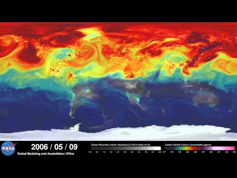
This is what the models said about CO2

hqdefault.jpg


This was the reality........See a problem there? Of course you don't. You're a fucking propagandist....

carbon-map_cf132431109ff079ed2ad22c005e42bf.nbcnews-ux-2880-1000.jpg
 
"Former NASA scientist Dr. Roy Spencer says that climate models used by government agencies to create policies “have failed miserably.” Spencer analyzed 90 climate models against surface temperature and satellite temperature data, and found that more than 95 percent of the models “have over-forecast the warming trend since 1979, whether we use their own surface temperature dataset (HadCRUT4), or our satellite dataset of lower tropospheric temperatures (UAH).”

Read more: http://dailycaller.com/2014/02/11/report-95-percent-of-global-warming-models-are-wrong/#ixzz4Tj0JkRpS
 
index.php


Looks like they are going to have warm temps for a while.


Oh? Let's take a look shall we? So, the maps are generated from forecasts, and models. Soooooooooo in oooother wooooords....they'rrrrrrrrre not reeeeeeaaallll.....

"These weather maps are generated from the NCEP Climate Forecast System version 2 (CFSV2) and CFS Reanalysis (CFSR) model frameworks. CFSV2 is the core of NCEP's operational Global Forecast System (GFS) model, available for April 2011 onward. CFSR is based on version 1 of CFS, and constitutes a state-of-the-art 3rd generation reanalysis. CFSR is available for January 1st, 1979 to 31 March, 2011 on a T382 gaussian grid (~38 km) with 64 vertical levels. CFSR/CFSV2 output fields shown here are from 0.5°x0.5° rectilinear grids downloaded from NCAR CISL Research Data Archive. Daily averages are computed from 3-hourly forecast fields beginning at 0000 UTC. The graphics here are generally updated at the end of each month (e.g., January output images are made at the beginning of February, and so on)."


They have a high probability of turning out true...Well, of course, you crap on everything that is science. Models are a important part of weather forecasting...Oh'nooo's we can't have models.


Let me know when computer derived fiction is considered "data" matt. Science cares about facts. When you present some I will certainly take notice. Projections, and models aren't DATA!
Now that kind of third grade logic works with jc, Silly Billy, and LaDumpkopf, your peers. But anyone that has worded with models knows that they are based on data. Do they always predict correctly? No, but they do have a better record than the 'Conservative' wingnuts. And the closer they are to the event, the more accurate they are. And those are pretty close to the event.
 

Forum List

Back
Top