Weatherman2020
Diamond Member
I hate New Orleans.Are you suggesting that Katrina's timeline refutes manmade global warming?
Where’s my CAT 6?
Follow along with the video below to see how to install our site as a web app on your home screen.
Note: This feature may not be available in some browsers.
I hate New Orleans.Are you suggesting that Katrina's timeline refutes manmade global warming?
You’re the expert. How often can I expect a CAT 6?The question is when you decided it was okay to lie.
Correct and it did so because the conditions existed (wind shear, water temperature and air moisture) for it to do so. Right?Otis was a Cat 5 when it struck, 24 hours after being a tropical storm. It went through Cat 2 in the time it took you to make your PBJ.
Th earliest satellite weather observations have only been available since 1960.There have always been unusual storms as well as unseasonal storms. The only difference today is that we have the capability to watch them in "real time", so are not surprised by them. People seen to forget that those kinds of capabilities have only been around for about a century.
Most of the storms went into the Atlantic this year. It's cyclical. Mr. Disingenuous would have us believe that it is a sign of an impending apocalypses, but that just isn't the case.Heck, I would love to know their reactions to an even more unusual storm.
The Great Galveston Hurricane of 1900 was the deadliest storm in US history. And it was only a category 4 when it smacked into Galveston. However, a week earlier when it hit the Dominican Republic and Cuba it was only a tropical storm. But it was still not done.
Like many hurricanes do, it passed inland and lost strength and weakened to a tropical depression. That is, for about 4 days until while over land it strengthened back into a hurricane once again and smacked into Ontario. And it finally died out after another 4 days over Iceland.
Now exactly how often does a hurricane reform over Ontario? Or a tropical storm continue on until it reaches Iceland?
Of course, then you also have Ivan. I remember that one very well.

That one smacked us hard and the tornadoes did a hell of a lot of damage. But most seem to have forgotten that once it passed into the Atlantic, it continued on. Hitting Florida after looping down the Eastern Seaboard, then hitting Louisiana a second time when it smacked into Texas.
There have always been unusual storms as well as unseasonal storms. The only difference today is that we have the capability to watch them in "real time", so are not surprised by them. People seen to forget that those kinds of capabilities have only been around for about a century.
How often was I supposed to get hit by a CAT 6 hurricane then?
Are you suggesting that Katrina's timeline refutes manmade global warming?
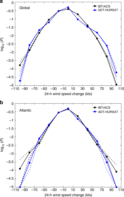
The first mode they identify is dependent on SSTs. The second only pushes storms to Cats 1 or 2. Read more carefully. Think things through. BEFORE you post shit that does nothing but point out your intellectual failings.Science Daily
Scientists find two ways that hurricanes rapidly intensify
New study may help forecasters better predict dangerous storms
Date:October 26, 2023Source:National Center for Atmospheric Research/University Corporation for Atmospheric ResearchSummary:Scientists at NCAR have identified two entirely different modes of hurricane rapid intensification. The findings may lead to better understanding and prediction of these dangerous events.
LINK
=================
Global warming, Climate Change or whatever the scam claim is has no bearing on this at all.
So you are arguing that the conditions for rapid development could not have existed without AGW?The first mode they identify is dependent on SSTs. The second only pushes storms to Cats 1 or 2. Read more carefully. Think things through. BEFORE you post shit that does nothing but point out your intellectual failings.
The first mode they identify is dependent on SSTs. The second only pushes storms to Cats 1 or 2. Read more carefully. Think things through. BEFORE you post shit that does nothing but point out your intellectual failings.
From your article:Why do you lie so much, there is nothing about global warming or climate change claims in it just a straightforward paper you clearly dislike.
I'm not the one that read poorly. The exceptional conditions in the Atlantic ocean at present feature exceedingly warm surface waters which your article lists as the cause for the rapid intesification of Andrew, Katrina, Maria and now Otis. As to the rest, I have been arguing for several days that climate science understood the cause of rapid intensification and that is precisely what your article states.From the paper you read poorly,
"Hurricanes that rapidly intensify for mysterious reasons pose a particularly frightening threat to those in harm's way. Forecasters have struggled for many years to understand why a seemingly commonplace tropical depression or tropical storm sometimes blows up into a major hurricane, packing catastrophic winds and driving a potentially deadly surge of water toward shore.
Now scientists have shed some light on why this forecasting challenge has been so difficult to overcome: there's more than one mechanism that causes rapid intensification. New research by scientists at the U.S. National Science Foundation (NSF) National Center for Atmospheric Research (NCAR) uses the latest computer modeling techniques to identify two entirely different modes of rapid intensification. The findings may lead to better understanding and prediction of these dangerous events.
"Trying to find the holy grail behind rapid intensification is the wrong approach because there isn't just one holy grail," said NCAR scientist Falko Judt, lead author of the new study. "There are at least two different modes or flavors of rapid intensification, and each one has a different set of conditions that must be met in order for the storm to strengthen so quickly."
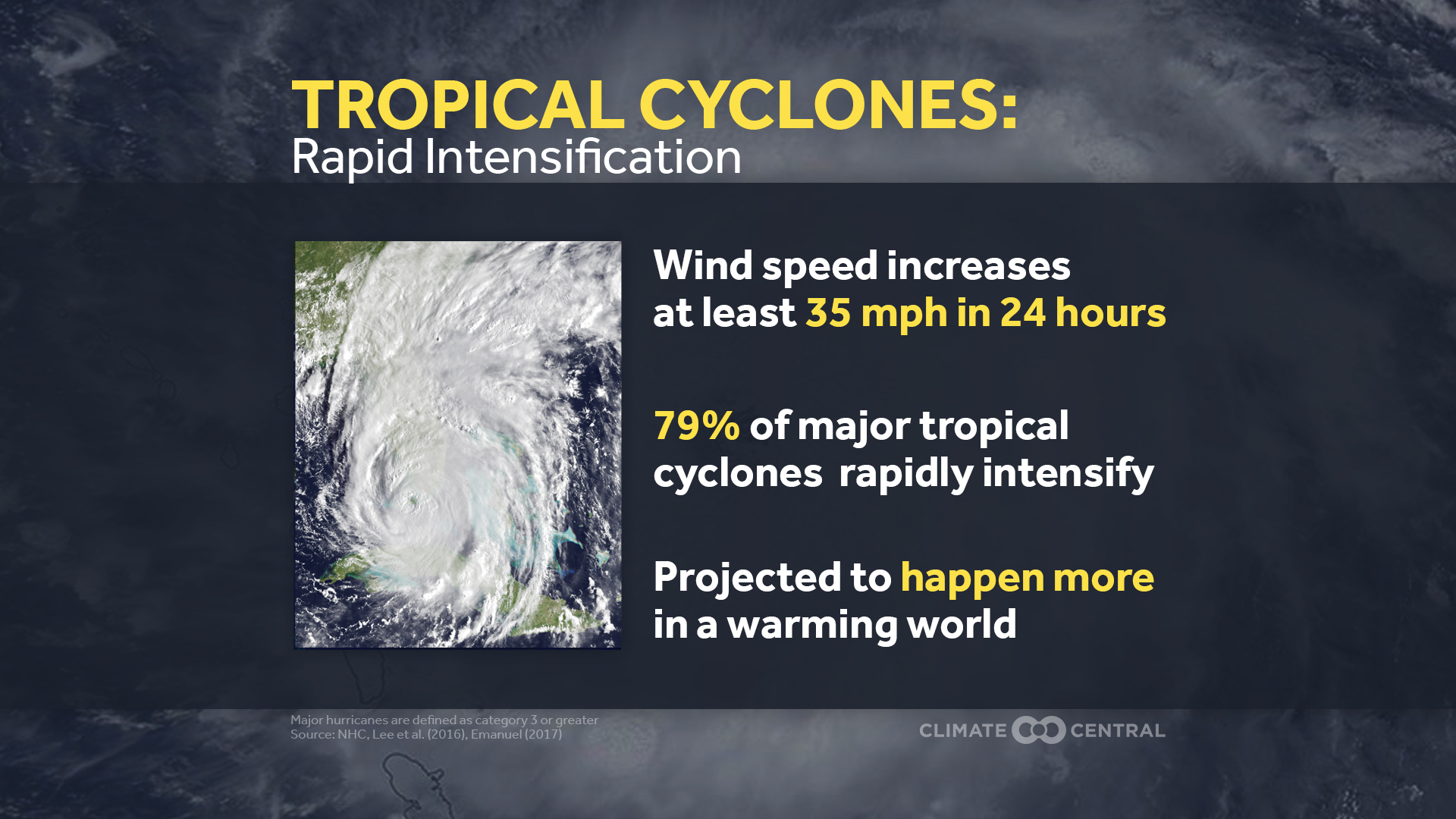
One of the modes discussed by Judt and his co-authors occurs when a hurricane intensifies symmetrically, fueled by favorable environmental conditions such as warm surface waters and low wind shear. This type of abrupt strengthening is associated with some of the most destructive storms in history, such as Hurricanes Andrew, Katrina, and Maria. Meteorologists were stunned this week when the winds of Hurricane Otis defied predictions and exploded by 110 miles per hour in just 24 hours, plowing into the west coast of Mexico at category 5 strength.
Judt and his co-authors also identified a second mode of rapid intensification that had previously been overlooked because it doesn't lead to peak winds reaching such destructive levels. In the case of this mode, the strengthening can be linked to major bursts of thunderstorms far from the storm's center. These bursts trigger a reconfiguration of the cyclone's circulation, enabling it to intensify rapidly, reaching category 1 or 2 intensity within a matter of hours."
and later in the report,
"Meteorologists have long known that favorable environmental conditions, including very warm surface waters and minimal wind shear, can generate rapid intensification and bring a cyclone to category 4 or 5 strength with sustained winds of 130 mph or higher. In their new paper, Judt and his co-authors referred to that mode of rapid intensification as a marathon because the storm keeps intensifying symmetrically at a moderate pace while the primary vortex steadily amplifies."
========
bolding mine
You read poorly.
So you are arguing that the conditions for rapid development could not have existed without AGW?From your article:
One of the modes discussed by Judt and his co-authors occurs when a hurricane intensifies symmetrically, fueled by favorable environmental conditions such as warm surface waters and low wind shear. This type of abrupt strengthening is associated with some of the most destructive storms in history, such as Hurricanes Andrew, Katrina, and Maria. Meteorologists were stunned this week when the winds of Hurricane Otis defied predictions and exploded by 110 miles per hour in just 24 hours, plowing into the west coast of Mexico at category 5 strength.
Judt and his co-authors also identified a second mode of rapid intensification that had previously been overlooked because it doesn't lead to peak winds reaching such destructive levels. In the case of this mode, the strengthening can be linked to major bursts of thunderstorms far from the storm's center. These bursts trigger a reconfiguration of the cyclone's circulation, enabling it to intensify rapidly, reaching category 1 or 2 intensity within a matter of hours.
This second mode is more unexpected because it typically occurs in the face of unfavorable conditions, such as countervailing upper-level winds that shear the storm by blowing the top in a different direction than the bottom.
I'm not the one that read poorly. The exceptional conditions in the Atlantic ocean at present feature exceedingly warm surface waters which your article lists as the cause for the rapid intesification of Andrew, Katrina, Maria and now Otis. As to the rest, I have been arguing for several days that climate science understood the cause of rapid intensification and that is precisely what your article states.
Fool.
Asked and answered, asshole.
Funny, no number thereAsked and answered, asshole.
yes, as well as the actual science or geology and climate, AGW is a bullshit religion which was created to make certain people insanely rich off of believers like you. The climate of our planet has been changing for hundreds of millions of years, and will be changing hundreds of millions or years after the last human is gone. We are not changing it, we may be polluting the air and water, but there is no solid proven link between pollution and climate. Why don't you libs take on pollution instead of the pushing the lie of manmade global warming?Are you suggesting that Katrina's timeline refutes manmade global warming?
AND, their prophet, the great algore said that by now the entire state of florida and much of the east coast would be under water---------------duh, its not.Most of the storms went into the Atlantic this year. It's cyclical. Mr. Disingenuous would have us believe that it is a sign of an impending apocalypses, but that just isn't the case.
From your article:
One of the modes discussed by Judt and his co-authors occurs when a hurricane intensifies symmetrically, fueled by favorable environmental conditions such as warm surface waters and low wind shear. This type of abrupt strengthening is associated with some of the most destructive storms in history, such as Hurricanes Andrew, Katrina, and Maria. Meteorologists were stunned this week when the winds of Hurricane Otis defied predictions and exploded by 110 miles per hour in just 24 hours, plowing into the west coast of Mexico at category 5 strength.
Judt and his co-authors also identified a second mode of rapid intensification that had previously been overlooked because it doesn't lead to peak winds reaching such destructive levels. In the case of this mode, the strengthening can be linked to major bursts of thunderstorms far from the storm's center. These bursts trigger a reconfiguration of the cyclone's circulation, enabling it to intensify rapidly, reaching category 1 or 2 intensity within a matter of hours.
This second mode is more unexpected because it typically occurs in the face of unfavorable conditions, such as countervailing upper-level winds that shear the storm by blowing the top in a different direction than the bottom.
I'm not the one that read poorly. The exceptional conditions in the Atlantic ocean at present feature exceedingly warm surface waters which your article lists as the cause for the rapid intesification of Andrew, Katrina, Maria and now Otis. As to the rest, I have been arguing for several days that climate science understood the cause of rapid intensification and that is precisely what your article states.
Fool.
The conditions for rapid development have been available for a long time as the waters are ALWAYS warm enough but wind shear and other weather variables are not always favorable for intensification as they vary all over the map, Otis had enough supporting weather factors to allow rapid intensification to develop and for that storm it was the massive thunderstorms that drove it up as explained in the paper.
As usual you are behaving like a warmist/alarmist who is allergic to official data and going bananas over something called WEATHER....
 www.climatecentral.org
 www.nature.com