Some Interesting Maps of the USA

JimBowie1958

Old Fogey
Sep 25, 2011
63,590
16,767
2,220
First lets start with a map of what our country looks like from above, the covering of the land in our country.

upload_2017-8-31_15-12-54.png


Then lets look at the cultural and ethnic heritage that is dominant in each county

upload_2017-8-31_15-13-57.png


upload_2017-8-31_15-15-11.png
 
Now lets look at some other interesting features, like the distribution of land and population.

upload_2017-8-31_15-16-11.png


upload_2017-8-31_15-16-32.png


upload_2017-8-31_15-16-52.png


upload_2017-8-31_15-18-28.png
 
These maps seem to offer several explanation of the current shift we are seeing in political demographics.

upload_2017-8-31_15-23-25.png


upload_2017-8-31_15-23-50.png


While Democrats are winning the voter concentrated urban areas, they are losing the rural areas badly.
 

Attachments

  • upload_2017-8-31_15-20-49.png
    upload_2017-8-31_15-20-49.png
    285.6 KB · Views: 33
The first map doesn't have a legend...what does the colors mean?
Specifically the pink and red
The red and pink areas are built up areas of human living space.

The dark green is forest, the light green a mix of human use and forest.
The brownish are agricultural use and so forth.
 
upload_2017-8-31_15-28-33.png


upload_2017-8-31_15-29-11.png


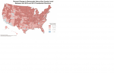
Just compare these two maps and see the huge losses of counties in the upper Mississippi, Rural New England and New York, NW Nevada, Montana, North Carolina, rural Colorado and New mexico, etc.

Meantime, Democrats gained in areas they already held firmly, California, and nose bleed union areas.

And since their polling is predominately of people who will come to the phone and answer or go on the internet, the rural areas are under represented and the Trump loss of the Carolinas, Florida, Iowa and Wisconsin did not happen among other similar states.

upload_2017-8-31_15-28-50.png


Trump won all the toss up states except Nevada, and took N Carolina and Pennsylvania too, blue states prior to the election.
 
Last edited:
View attachment 146900

View attachment 146902

Just compare these two maps and see the huge losses of counties in the upper Mississippi, Rural New England and New York, NW Nevada, Montana, North Carolina, rural Colorado and New mexico, etc.

Meantime, Democrats gained in areas they already held firmly, California, and nose bleed union areas.

And since their polling is predominately of people who will come to the phone and answer or go on the internet, the rural areas are under represented and the Trump loss of the Carolinas, Florida, Iowa and Wisconsin did not happen among other similar states.

View attachment 146901

Trump won all the toss up states except Nevada, and took N Carolina and Pennsylvania too, blue states prior to the election.

The images don't show up but just on this point above --- neither NC nor PA are "blue" states. They're in effect purple. They go either way.

I'm a twelve-year resident of one and was born and raised in the other.
 
The rural areas want the jobs and opportunities of the cities, without having to put in any of the work or having to interact with people from different backgrounds.
 

Forum List

Back
Top