Watching the sea ice

ScienceRocks

Democrat all the way!
Mar 16, 2010
59,455
6,798
1,900
The Good insane United states of America
Yes, watching the sea ice! hahaha

moyhu: Latest Ice and Temperature data

Jax has us in 3rd behind 2007 and 2012.
pol0.png


IJIS:

5,397,050 km2(August 12, 2017)and 3rd lowest measured for the date.

Down 139k over the two days.

2017 is now below the average minimum from the 2000s (2000 - 2009), which was 5,479,091

In 11th place at present with 34 days approx left

The weather pattern is very much like 2013 which was very cold! So we're kicking ass for such a cold weather pattern. A 2016, 2015, 2012, 2007 like weather pattern would have beaten 2012.

NSIDC has us in second! ;)

po2.png

Charctic Interactive Sea Ice Graph | Arctic Sea Ice News and Analysis
 
  • Thread starter
  • Banned
  • #5
According to the NOAA-ESRL measurements 2017 has been colder than 2013 and 2014 in both the Arctic and the high Arctic (80N+) over most of the May - Jul period and on average.

And yet we're 2nd or 3rd place depending on database. Not bad for having the weather against it.
 
Sensor on F-17 experiencing difficulties, sea ice time series temporarily suspended

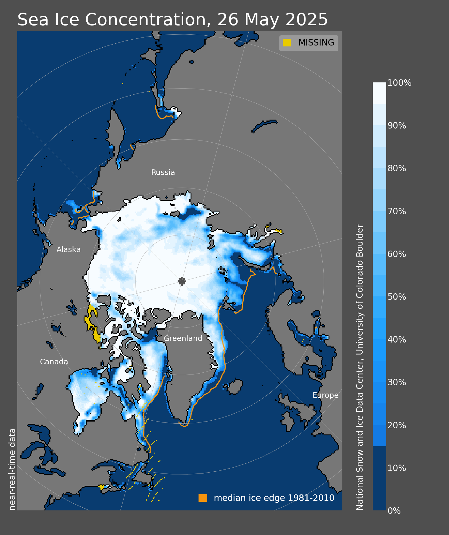
NSIDC has suspended daily sea ice extent updates until further notice, due to issues with the satellite data used to produce these images. The vertically polarized 37 GHz channel (37V) of the Special Sensor Microwave Imager and Sounder (SSMIS) on the Defense Meteorological Satellite Program (DMSP) F-17 satellite that provides passive microwave brightness temperatures is providing spurious data. The 37V channel is one of the inputs to the sea ice retrieval algorithms, so this is resulting in erroneous estimates of sea ice concentration and extent. The problem was initially seen in data for April 5 and all data since then are unreliable, so we have chosen to remove all of April from NSIDC’s archive.

It is unknown at this time if or when the problem with F-17 can be fixed. In the event that the sensor has permanently failed, NSIDC is working to transition to either the DMSP F-18 or possibly the JAXA Advanced Microwave Scanning Radiometer 2 (AMSR2) on the Global Change Observation Mission – Water (GCOM-W) satellite. Transitioning to a different satellite will require a careful calibration against the F-17 data to ensure consistency over the long-term time series. While this transition is of high priority, NSIDC has no firm timeline on when it will be able to resume providing the sea ice time series. For background information on the challenges of using data in near-real-time, see the ASINA FAQ, “Do your data undergo quality control?


Source: Sensor on F-17 experiencing difficulties, sea ice time series temporarily suspended | Arctic Sea Ice News and Analysis

These issues have not yet been resolved... The data problems are leaving the whole of the sensing system in question.. And no satellite has yet been placed to replace and correct the systemic failure.. The 15% ice levels are SWAG's and in question.


You show him a problem with the satellite that gathers the data and what does he do in response, shows you more data gathered by the satellite. Circular reasoning at its best if you can call it reasoning at all.
 
My wife was binge watching a British baking show. The cooks will often have to turn their cakes in the oven because they don't bake uniformly. In a sealed oven, there are variations in temperature and the mix that affect the bake. It's the same way the Warmers "measure" the "warming". They highlight microvariations as if they were significant and all the while Guam is still upright and above water
 
Sensor on F-17 experiencing difficulties, sea ice time series temporarily suspended

NSIDC has suspended daily sea ice extent updates until further notice, due to issues with the satellite data used to produce these images. The vertically polarized 37 GHz channel (37V) of the Special Sensor Microwave Imager and Sounder (SSMIS) on the Defense Meteorological Satellite Program (DMSP) F-17 satellite that provides passive microwave brightness temperatures is providing spurious data. The 37V channel is one of the inputs to the sea ice retrieval algorithms, so this is resulting in erroneous estimates of sea ice concentration and extent. The problem was initially seen in data for April 5 and all data since then are unreliable, so we have chosen to remove all of April from NSIDC’s archive.

It is unknown at this time if or when the problem with F-17 can be fixed. In the event that the sensor has permanently failed, NSIDC is working to transition to either the DMSP F-18 or possibly the JAXA Advanced Microwave Scanning Radiometer 2 (AMSR2) on the Global Change Observation Mission – Water (GCOM-W) satellite. Transitioning to a different satellite will require a careful calibration against the F-17 data to ensure consistency over the long-term time series. While this transition is of high priority, NSIDC has no firm timeline on when it will be able to resume providing the sea ice time series. For background information on the challenges of using data in near-real-time, see the ASINA FAQ, “Do your data undergo quality control?


Source: Sensor on F-17 experiencing difficulties, sea ice time series temporarily suspended | Arctic Sea Ice News and Analysis

These issues have not yet been resolved... The data problems are leaving the whole of the sensing system in question.. And no satellite has yet been placed to replace and correct the systemic failure.. The 15% ice levels are SWAG's and in question.

In case you did not notice, Silly Billy, the OP started out with a graph from JAX, which is working just fine.
 

Forum List

Back
Top