- Thread starter
- #61
Not by mainstream science from global warming.You were promised all mankind dead. Never happens chicken little.
Follow along with the video below to see how to install our site as a web app on your home screen.
Note: This feature may not be available in some browsers.
Not by mainstream science from global warming.You were promised all mankind dead. Never happens chicken little.
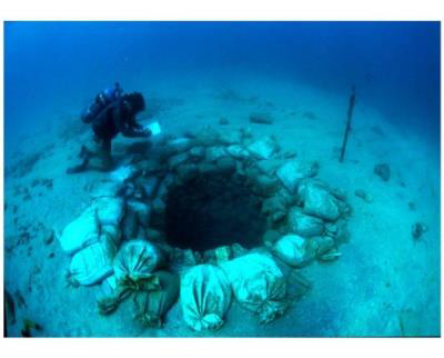
Geologists examining shale deposits have determined the likely kill mechanism in several mass extinction events: a loss of oxygen and simultaneous build up of hydrogen sulfide. A rapid rise in sea level from Greenland and/or Antarctic ice sheet destabilization could produce similar conditions.

Geologists Discover a Critical Kill Mechanism Behind a 350 Million-Year-Old Series of Extinctions
A major oil source in North America reveals insights into one of the planet's most devastating mass extinctions. The Bakken Shale Formation, spanning an area of 200,000 square miles beneath parts of Canada and North Dakota, has been a prolific source of oil and natural gas for North America for thescitechdaily.com
 www.science.org
You were promised all mankind dead. Never happens chicken little.

[.....]And if this dramatic sea level is so devastating, why do we not see the loss of land in the FL Keys where elevations are, in many places, below the level they claim the sea has increased to? Hmmm.[.....]
[.....]
""Sea level measured at the Key West gauge has risen approximately 3.9 inches from 2000 to 2017. According to the graph, the mean sea level rise is projected to be the following:
- 10 to 17 inches from 2000 to 2040 (sea levels have already risen 4 inches through 2017, this means a net additional 6 to 13 inches is projected from 2018 to 2040.)
- 21 to 54 inches from 2000 to 2070 (sea levels have already risen 4 inches through 2017, this means a net additional 17 to 50 inches from 2018 to 2070.)
- 40 to 136 inches by 2120
Sustainability | Monroe County, FL - Official Website
(The Keys are in Monroe County)
`
Note the Mentally Ill Huge posts,
Giant Spacing and Graphics
used by Institution Escapee EMH.
(as a substitute for Content/illusion of Content..
and to 'shout down'/Bury his opponents.)
Political Chic used to do the same here/elsewhere
Mod Mister-Beale loads up on the JPGs too.
`
Don’t you remember the 10s of trillions of scientists that signed off on Bubba Gores predictions?Not by mainstream science from global warming.

Co2 will never cause this because Co2 has precisely NOTHING to do with Earth climate change.
Sea level is 100% about ice.
Where is the ice?
It is on LAND NEAR THE POLES... and LAND MOVES... DUH....
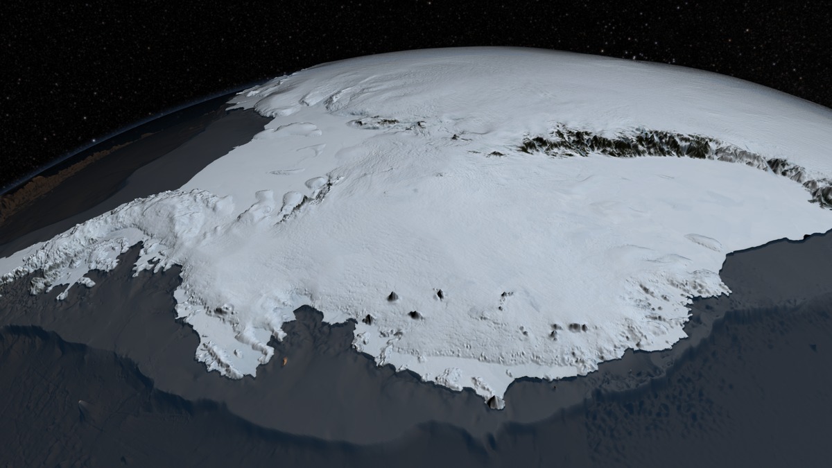
90% Earth ice on Antarctica
7% on Greenland
0.3% on Ellesmere Island

This is like the folks who do not like the question
WHY are there NO PHOTOS of "Osama" in Saudi???
Show us PHOTOS of landmarks "sinking" or STFU about fudged fraud "ocean rise"
What do you mean CO2 has nothing to do with Earth's climate change. Of course it does. It's a greenhouse gas, it means that without CO2, most likely the planet would be a ball of ice. With loads more it would also be a ball of ice (stopping sunlight getting in). It literally has an impact.
You know what happens when ice in the oceans melts?
As Co2 increased in the atmosphere, highly correlated satellite and balloon data showed NO WARMING in the atmosphere.
All gasses absorb some part of EM spectrum. Co2 absorbs weak IR, which is why it does NOTHING.

Well.... that depends on how much CO2 there is and what you're expecting the temperature increase to be. You also need to take into account what else is in the atmosphere at the time.
But then again, you didn't post that data you're claiming, so I can't check it.
Greenhouse gas - Wikipedia
en.wikipedia.org
About 1/3rd of the way down is a chart which shows that, yes, CO2 isn't that effective as a greenhouse gas, however there is a hell of a lot of it in the atmosphere. There always has been, it's part of what keeps Earth warm enough for life.

 www.nbcnews.com
90% of Earth ice is ON LAND MASS Antarctica
7% on Greenland
0.3% on Ellesmere Island
The rest, 2.7% is in mountain ranges and sea ice....
Sea Ice is on a long term decline in the Arctic due to the growth of the Arctic Ocean
Sea Ice is on a long long long term increase in the Antarctic due to a 40+ million year old continent specific ice age....
Key claim against global warming evaporates
Satellite and weather balloon data used to argue that climate models were wrong and that global warming isn't really happening turns out to be based on faulty analyses, according to three new studies.
satellite and weather balloon data have actually suggested the opposite, that the atmosphere was cooling.
"Most people are surprised to learn that, just as the surface of the Earth is not flat, the surface of the ocean is not flat, and that the surface of the sea changes at different rates around the globe. For instance, the absolute water level height is higher along the West Coast of the United States than the East Coast.Come on. Even over an irregular sea floor, the surface level would still be approximately the same.
 www.sciencefocus.com
For probably the tenth time, that rock was moved in 1921 and you have NO IDEA what the tides were when that photo was taken. The normal tidal range in Plymouth Harbor is fucking 9.76 feet!! See Station Home Page - NOAA Tides & Currents.This is why the measurements of landmarks like Plymouth Rock tend toward a fair challenge to the claims of the alarmists.
You have to get away from this somewhat common idea that the Earth changing "naturally" doesn't require a cause. Nothing happens without a cause; not a wee puff of a air, not a hurricane, not a drop of rain, not a once-in-a-milennium flood. Sea levels rise and fall in the pre-human past has been caused primarily by temperatures. Falling temperatures shrink the physical volume of the ocean and land-borne ice ties up large volumes of water. Rising temperatures melt that ice and expand the ocean's volume. Temperatures of the land, the air and the oceans have been rising for the past 150 years. That has caused the oceans to expand and for a significant portion of the world's ice to melt - and continute melting. THAT is what is currently causing the world's oceans to rise.We all know that sea levels are variable over long periods of time, naturally.
How is it that you seem to feel comfortable making statements for which you KNOW you have no evidentiary support and which hard science clearly refutes.Ice ages led to water being locked up in ice on land. Ocean levels fell and the Bering Land Bridge could come into being.
But there isn’t much evidence that present day human behavior has actually impacted our ocean levels.
 sealevel.nasa.gov


You're posting things without much of a reason.
Antarctic ice sheet - Wikipedia
Antarctica "contains 26.5 million cubic kilometres (6,400,000 cubic miles) of ice."

Antarctica "contains about 30 million cubic kilometers (7.2 million cubic miles) of ice."
The Arctic "contains about 2.9 million cubic kilometers (696,000 cubic miles) of ice."
See how simple it is to post the actual facts.
But so what? What does this mean? Or do we just post facts and then don't make an argument?
Did you read it?
"The atmosphere is indeed warming, not cooling as the data previously showed."
"Now, according to three new studies published in the journal Science, it turns out those conclusions based on satellite and weather balloon data were based on faulty analyses."
"Nowadays, radiosondes are better insulated against the effects of sunlight, but if analyzed together with the old data—which showed temperatures that were actually warmer than they really were—the overall effect looked like the troposphere was cooling."
So it looked like cooling because the way measurements were taken was wrong....
"Most people are surprised to learn that, just as the surface of the Earth is not flat, the surface of the ocean is not flat, and that the surface of the sea changes at different rates around the globe. For instance, the absolute water level height is higher along the West Coast of the United States than the East Coast.
You may have heard the term “global sea level,” which refers to the average height of all of the Earth's ocean basins. "Global sea level rise" refers to the increase in the average global sea level trend.
"Local sea level" refers to the height of the water measured along the coast relative to a specific point on land. Tide stations measure local sea level. "Relative sea level trends" reflect changes in local sea level over time. This relative change is the one most critical for many coastal applications, including coastal mapping, marine boundary delineation, coastal zone management, coastal engineering, sustainable habitat restoration design, and the general public enjoying their favorite beach."
Is sea level the same all across the ocean?
The sea level varies around the globeoceanservice.noaa.gov
Abstract
Interannual variability of sea surface height (SSH) in western Pacific Ocean and eastern Indian Ocean occurs as a result of the ENSO phenomena. This variability affects SSH difference between both of those oceans. In normal condition, SSH in western Pacific Ocean is higher than in eastern Indian Ocean which causes a current that passes through Indonesia which known as the Indonesian Throughflow (ITF). This study used SSH and geostrophic currents data from 1993 to 2015 which obtained from AVISO satellite altimetry data to determine the variability of SSH difference in ENSO condition which represented by the sea surface temperature (SST) anomaly of Niño 3.4 data from NOAA and its relation to the geostrophic currents in Lombok Strait which is one of the ITF crossing path. The result of the correlation calculation of ENSO condition to SSH difference between western Pacific Ocean and eastern Indian Ocean shows the negative value. It means that SSH difference at both oceans have opposite condition that when El Nino happened SSH in western Pacific Ocean is lower than the eastern Indian Ocean and when La Niña happened SSH in the western Pacific Ocean is higher than the eastern Indian Ocean. The SSH difference does not affect the direction of geostrophic currents but affects its speed.
Radware Bot Manager Captcha
iopscience.iop.org
"But while their surface provides a handy reference point, the oceans themselves are not all at the same height above the Earth’s centre. As the strength of the force generated by the Earth’s spin is strongest at the equator, the MSL bulges outward there, putting it further from the centre of the Earth than at the poles."
"Mean sea level (MSL) is widely used as the standard reference for the altitude of towns, mountains and aircraft. That’s because once the effect of tides and waves has been averaged out, sea level depends on just two forces: the strength of gravity and the effect of the Earth’s spin – and these depend on the distance from that ultimate reference point, Earth’s centre."
"Differences in the Earth’s density also affect the strength of gravity, causing MSL variations of as much as 100 metres. MSL is also changing over time, largely through global warming causing seawater to expand and land ice to melt."
Are all the world’s oceans at the same level?
For probably the tenth time, that rock was moved in 1921 and you have NO IDEA what the tides were when that photo was taken. The normal tidal range in Plymouth Harbor is fucking 9.76 feet!! See Station Home Page - NOAA Tides & Currents.
You have to get away from this somewhat common idea that the Earth changing "naturally" doesn't require a cause. Nothing happens without a cause; not a wee puff of a air, not a hurricane, not a drop of rain, not a once-in-a-milennium flood. Sea levels rise and fall in the pre-human past has been caused primarily by temperatures. Falling temperatures shrink the physical volume of the ocean and land-borne ice ties up large volumes of water. Rising temperatures melt that ice and expand the ocean's volume. Temperatures of the land, the air and the oceans have been rising for the past 150 years. That has caused the oceans to expand and for a significant portion of the world's ice to melt - and continute melting. THAT is what is currently causing the world's oceans to rise.
How is it that you seem to feel comfortable making statements for which you KNOW you have no evidentiary support and which hard science clearly refutes.
How much do human activities contribute to sea-level rise? – NASA Sea Level Change Portal
Visit NASA's portal for an in-depth look at the science behind sea level change.Causes of Sea Level Rise
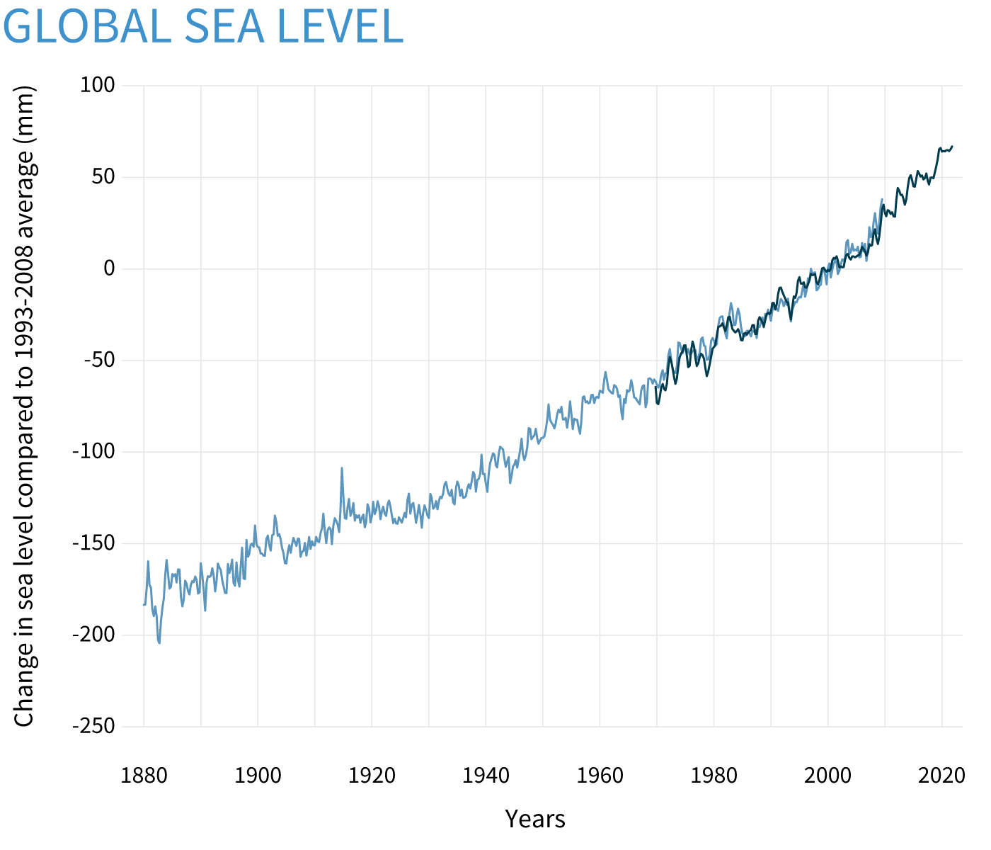
Sea level is rising -- and at an accelerating rate -- largely in response to global warming. A 2013 fact sheet from the Union of Concerned Scientists.www.ucsusa.org
Sea level rise, facts and information
Seas are predicted to rise a foot by 2050, regardless of how much global carbon emissions can be reduced. Why is this happening, and what can we do to adapt?www.nationalgeographic.com
Climate Change: Global Sea Level
Sea level has risen 8-9 inches since 1880, and the rate is accelerating thanks to glacier and ice sheet melt.www.climate.gov
Show us ONE SINGLE PHOTO of a landmark sinking...
The same demographic cannot answer either... because that demographic has NO CONCERN FOR TRUTH OR AMERICA.