usmbguest5318
Gold Member
- Jan 1, 2017
- 10,923
- 1,635
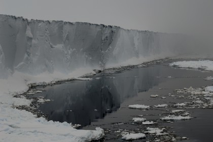
Anyone who saw a chunk of ice the size of Delaware floating free in the water would have noticed it.Who would have noticed one two weeks ago, Einstein?Well considering the Extremely short period we have been able to record calving events, there is no way to know how large this one is by comparison. 10 icebergs 3 times this size could have calved off prior to this one. The first recorded sighting of Antarctic Ice Shelf wasn't until the 1800's. We have no clue what occurred before that with respect to calving. Remember, climatology is the study weather over l o n g periods of time, periods of times measured by decades and centuries. Perspective my friend, perspective.The first recorded sighting of Antarctic Ice Shelf wasn't until the 1800's.
Do you think sailors making the Drake Passage would not have noticed an iceberg the size of Delaware? The passage itself is only about 200 miles wide. I can assure you they's notice a block of ice the size of Delaware and it wouldn't have to be right in front of them for them to do so.You can't see the iceberg from the course he took, dufus.


Calculate how far away an object 200 meters into the air can be for one to see it on the ocean while standing in the "crows nest" some 150-200 feet (my guess based on knowing that the main mast on my boat, which is considerably smaller than the Golden Hind, is reaches 70 feet) above sea level.


Dude, you are clueless. Save your theoretical calculations and deal with 3 doses of reality-
Reality 1-
International waters are 12 nautical miles (22.2 km; 13.8 mi) from shore. This is largely because when on a ship (or about the same vantage point above the surface on shore), you can see a ship breach the horizon at about the 12 mile mark. (Both you and the ship are above sea level/horizon.) Boat captains say, on average, you can see ships on the horizon or land at about 12 miles. Of course that assumes clear skies and no fog.
Reality 2-
Ice bergs get smaller as they move away from the ice shelf, and they break into pieces. There is no chance that a large ice berg would stay intact until it became visible from a ship passing thru the passage.
Reality 3-
The path of the ice berg can not be predicted, but if it follows the path of other calved bergs, it won't be passing thru Drakes Passage. Boats travel the passage generally would not want to go farther south than necessary. Sorry, you lost Big with this one.
View attachment 139160
Ice bergs get smaller as they move away from the ice shelf, and they break into pieces. There is no chance that a large ice berg would stay intact until it became visible from a ship passing thru the passage.
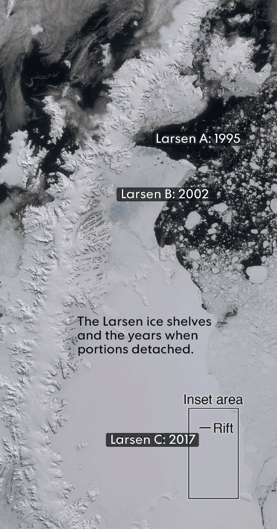
Iceberg A-38 broke off the Filchner-Ronne Ice Shelf in 1998. It was the size of Connecticut. It broke in half in 2004.

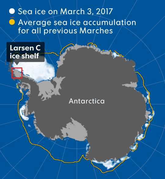
B-15, the largest ever recorded iceberg, calved off of Antarctica in 2000. It broke into smaller pieces, one of which was B-15J. B-15J was spotted ~1700 miles southeast of New Zealand. At that time, November 2011, it was ~12 miles across. By December 2011 it'd crumbled/melted to a few miles, not a few hundred feet, across. (1700 miles is about half the distance between New Zealand and Antarctica.)
"Until 2010, the largest iceberg in the Northern Hemisphere was seen near Baffin Island, Nunavut, in 1882. It was 8 miles long, 3.7 miles wide and 64 feet high." The point is that, yes, state-sized icebergs (BABs -- big ass 'bergs) break apart as they head into warmer waters, but one'd expect sailors, merchants, whalers, marine researchers, pilots, thrill seekers, explorers, etc. collectively to see many town/city sized ones had icebergs the size of states been breaking off "all the time" for thousands of years. ("Many" being appreciably more than than one or four since 1882.) And yet, what we've observed is that BABs and remnants of them have appeared in the past 20 or so years at a notably greater frequency -- every two to four years -- than they did between 1979 and 1997, during which period there was one.
Then there's the fact that such huge chunks of ice take literally several thousand years to form -- Larsen C took something in excess of 3200 years to form. For such BABs to calve off at the rate you suggest -- "all the time for thousands of years" -- there'd have to have been a hell of a lot more ice on the polar caps than has been recorded over the past centuries. That is to say, the Ross, Larsen, et al ice shelves would have to have been considerably larger than they were recorded as being. The rate you're suggesting is too fast for the ice to reform into new shelves and then re-calve as yet another BAB and hold constant the size of the shelf from which the BAB calved. (Geological evidence indicates that the last time Antarctica was ice free was 4000 BC, some 6000 years ago. Some argue that it was 9000 to 13000 years ago, even longer ago, not more recently.)
Last edited: